Map sources
A living inventory of the cartographic and geometry data sources behind the Uitwijken.nl map — the base tiles, administrative boundaries, and address/building geometry that make cascading geography possible before there is any user activity.
This page is concrete vendor- and API-level detail, the map counterpart to Event-sources (which inventories event pins). The principles for why open data matters live in Open-data. The dated record of how this inventory was built lives in Research-log.
Unlike events — where the salient question is commercial gating — almost every source here is open Dutch government data. The axis that matters is layer function: what each source contributes to the stack. Most of the foundation is served by PDOK (the national geodata platform, run by Kadaster) and data.amsterdam.nl (the municipal DSO-API), both free and no-auth.
Last reviewed: 2026-06-02
Recommended stack
A buurt-scale civic map can be built end-to-end on open data with no commercial dependency:
- Base canvas — PDOK BRT Achtergrondkaart vector tiles (free, CC-BY). MapTiler/Mapbox only if a custom global style is ever worth the cost.
- Boundaries — Amsterdam
gebiedenAPI for the city's own stadsdeel → wijk → buurt hierarchy (this is the indeling the platform should use); CBS Wijk- en Buurtkaart when national comparability or statistics are needed. - Addresses & buildings — PDOK BAG OGC API / vector tiles for the map layer; PDOK Locatieserver for the search box; Kadaster BAG Individuele Bevragingen for "what's at this point" lookups.
- Street-level detail — PDOK BGT vector tiles when zoomed into a single buurt (pavements, greenery, water).
- Civic overlays — events via Event-sources; meldingen, permits, plans via the municipal DSO-API and Open-data.
Rationale: prefer national basisregistraties (stable, authoritative, openly licensed) for the foundation; use Amsterdam's own services where the city's indeling or freshness beats the national mirror.
What the layers look like
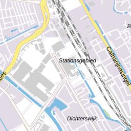
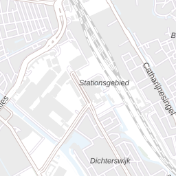
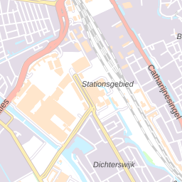
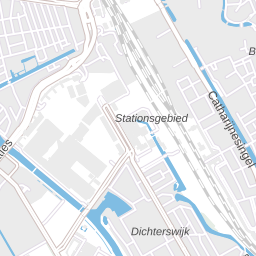
Live previews pulled straight from the open services — same central-Amsterdam location across the base-map styles. These are hotlinked from PDOK (no captured screenshots); if they ever fail to load it's a transient service issue, not a broken inventory.
BRT-A base-map styles (standaard · grijs · pastel · water):
CBS buurt boundaries (WMS render over central Amsterdam):
BAG building footprints (WMS render, centrum):
Base map tiles — the canvas
| Source | URL | Type | Auth | License | Notes |
|---|---|---|---|---|---|
| PDOK BRT Achtergrondkaart (BRT-A) | WMTS · vector tiles | WMTS + OGC API Tiles/Styles | None | CC-BY 4.0 (© Kadaster) | Standard Dutch national base map. Styles: standaard, grijs, pastel, water. RD / ETRS89 / WebMercator. The default canvas |
| Amsterdam basiskaart | WMTS | WMTS | None | Bespoke municipal terms (fees: none) | City's own topo + 30+ luchtfoto (aerial 2003–2025) layers. topo_rd / _light / _zw + WebMercator twins. Higher freshness than national mirror; non-CC terms |
| OpenStreetMap | site | Raster / vector tiles | None (own tile server / provider) | ODbL | Global fallback, rich POI detail. Tile hosting via own server or a provider; respect OSMF tile-usage policy |
| MapTiler | site | Vector tiles + styling | API key | Commercial | Only if a custom global style / hosting convenience justifies cost |
| Mapbox | site | Vector tiles + styling | API key | Commercial | Same as MapTiler — avoid lock-in unless styling needs demand it |
Administrative boundaries — the cascading scales
| Source | URL | Type | Auth | License | Notes |
|---|---|---|---|---|---|
| Amsterdam gebieden | REST · WFS | REST + WFS | None (key rolling out) | Public (effectively CC-BY) | Levels: stadsdelen, wijken, buurten, ggwgebieden, ggpgebieden, bouwblokken. RD/EPSG:28992. Amsterdam's own indeling — carries a cbsCode field because it does not map 1:1 to CBS. Use this for the platform's scales |
| CBS Wijk- en Buurtkaart | WFS | WFS + OGC API + ATOM | None | CC-BY 4.0 | Annual (year in path). gemeente / wijk / buurt polygons with CBS codes + statistics (population, density…). No native stadsdeel layer — Amsterdam stadsdelen sit at CBS wijk level. For national comparability and choropleths |
Addresses & buildings
| Source | URL | Type | Auth | License | Notes |
|---|---|---|---|---|---|
| PDOK BAG | OGC API | OGC API Features / Vector Tiles / Styles | None | CC-0 (public domain) | pand = building footprint polygons, verblijfsobject = address points, ligplaats/standplaats polygons. For the map layer and bulk use |
| PDOK Locatieserver v3_1 | docs | REST (suggest / lookup / free / reverse) | None | Public | The geocoder for the search box. Returns RD + WGS84 coords and BAG IDs; reverse geocode by X/Y. Migrated off the retired nationaalgeoregister URLs in 2023 |
| Kadaster BAG Individuele Bevragingen v2 | docs | REST | Free key | Public | Single-object lookups ("what's at this point") at api.bag.kadaster.nl/lvbag/individuelebevragingen/v2. 50k queries/day, 50 req/s — not for bulk. Register via developer.kadaster.nl |
Street-level detail
| Source | URL | Type | Auth | License | Notes |
|---|---|---|---|---|---|
| PDOK BGT | OGC API | OGC API Features / Vector Tiles + WMTS + Download | None | CC-0 | Pavements (wegdeel), greenery, water, panden at street level. No WFS (deprecated). Features API caps at 1,000/request — render via vector tiles/WMTS, query Features only in a small bbox |
| PDOK NWB (Nationaal Wegenbestand) | docs | WMS / WFS / OGC API / ATOM | None | CC-0 | Road centerlines + hectometer points. For routing / road reference; secondary to BGT for a buurt map |
Civic overlays
The layers that drape on the base map. These mostly live in other inventories — listed here so the full map stack is legible in one place.
| Layer | Source | Where inventoried |
|---|---|---|
| Events this week | Amsterdam Datapunt Evenementen, Ticketmaster, JSON-LD | Event-sources |
| Meldingen / public-space reports | WFS — public read, CC-BY, point geometry from 2018 on | This page (Signalen output is openly published, unlike the write-side app) |
| Permits & planning | Municipal DSO-API datasets | Open-data (principles) — not yet inventoried at API level |
| Budgets & consultations | buurtbudget, Stadspas, Decidim-style channels | Open follow-up — see Event-sources open questions |
Open questions
These weren't fully resolved in the 2026-06-02 scan and are worth a follow-up before locking the architecture:
- Platform API keys. Both PDOK-side BAG (Individuele Bevragingen) and data.amsterdam.nl are rolling toward mandatory keys with no firm deadline announced. Code should be ready to send a key. This is the biggest forward-looking risk for a third-party integrator.
- Exact BAG/BGT collection identifiers — verify against the live
/collectionsJSON before hard-coding field names. - Amsterdam
gebiedenlicense string — the dataset page shows "Licentie: -" while the data is openbare data; behaviorally CC-BY but not formally tagged. Confirm before relying on attribution terms. - Municipal map-relevant datasets (parkeervakken, bomen/trees, and the broader permits/plans layer) — named in Open-data but never inventoried at endpoint level the way events were. A natural next dive.
- Vector-tile performance at buurt scale — BGT detail is heavy; test real render budgets before committing to it as more than a zoomed-in layer.
Implications for product
- The map foundation is a closed question. Base tiles + boundaries + addresses can ship entirely on PDOK + data.amsterdam.nl, free and openly licensed. No commercial cartography dependency is required for the proof-of-concept.
- Use Amsterdam's indeling, not CBS, for the platform's scales — but keep the
cbsCodelink so national statistics can still be joined. - One geocoder, one base style, reused everywhere — invest in the PDOK Locatieserver search box and a single BRT-A style as shared infrastructure, the same way Event-sources argues for one JSON-LD extractor.
- Licensing is mixed — BGT/NWB are CC-0, BRT-A/CBS are CC-BY (attribution line needed), Amsterdam basiskaart has bespoke terms. Track per-layer attribution from the start.
- What's still open is the civic-overlay layer — permits, plans, budgets — not the cartography. That's where the next research dive should go.
Tags
#year/2026 #city/amsterdam #data/maps